

The software behind AirWarden Remote ID and AirWarden Spectrum.
SOFTWARE OVERVIEW
Real-Time Detection Meets Historical Intelligence
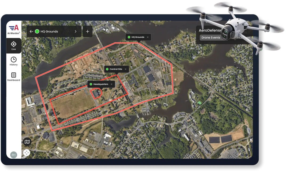
AirWarden® Essentials supports both AirWarden Remote ID and AirWarden Spectrum, combining live drone monitoring with historical intelligence.
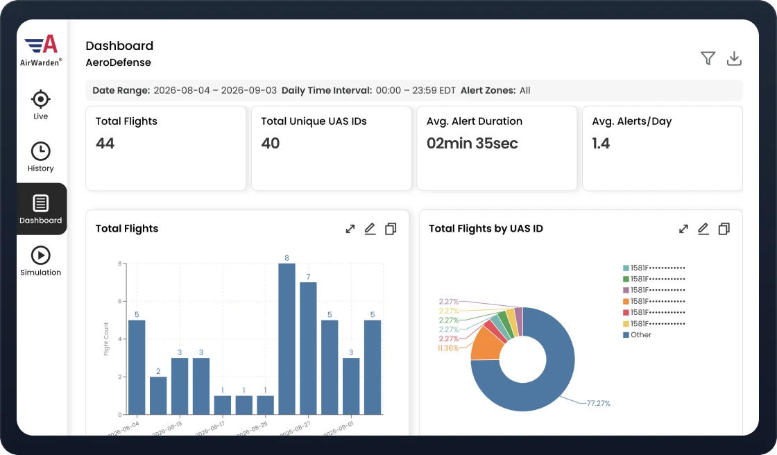
Track activity as it happens, receive configurable alerts, and use built-in dashboards that automatically turn detection history into clear charts, trends, and activity summaries to inform security decisions.
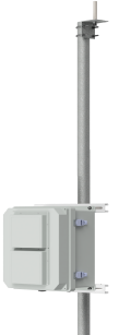
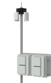
Choose Your Detection Hardware
Pair AirWarden Essentials software with the detection hardware that
fits your monitoring needs.
Follow live drone activity, view flight details, and receive alerts to
support your team’s response.
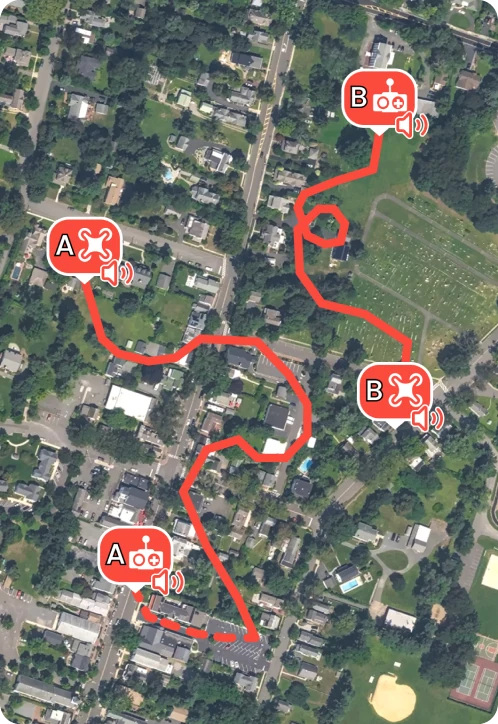
Real-Time Flight & Pilot Tracking
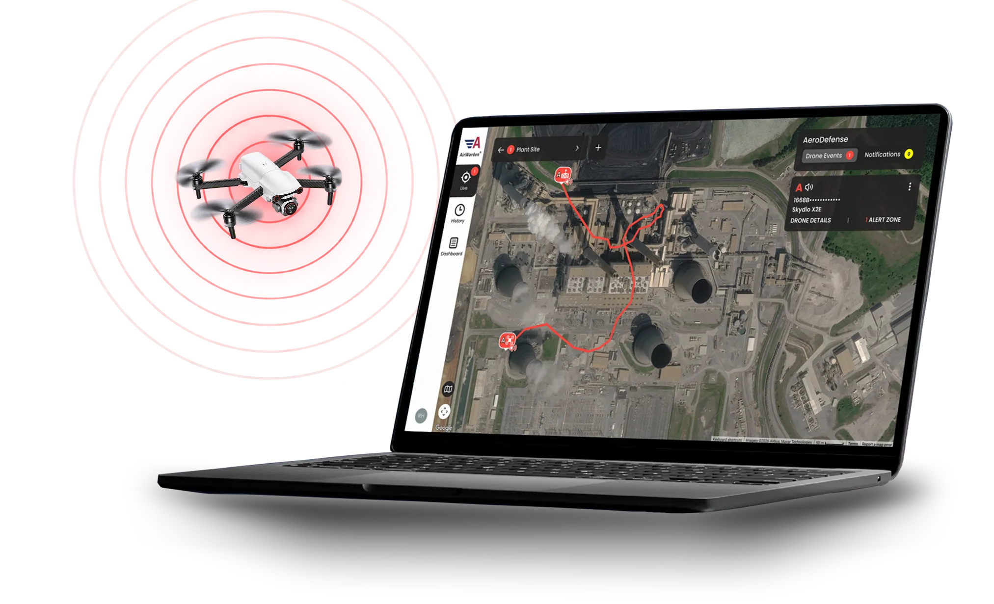
Track drone and pilot movements as they happen, with customizable alert zones to protect critical perimeters.
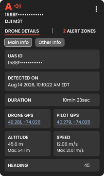
Actionable Airspace Intelligence
View comprehensive flight telemetry—from UAS ID to speed and altitude—for complete situational awareness.
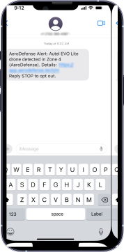
Automated Field Notifications
Route SMS and email alerts directly to security teams and local law enforcement for rapid, coordinated response.
SMARTER AIRSPACE MONITORING
Turn Drone Activity Into Actionable Insights
01
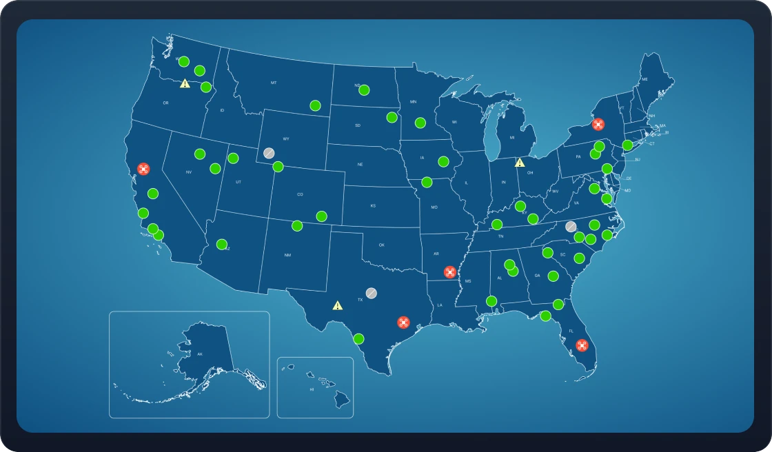
Monitor Multiple Locations From One Screen
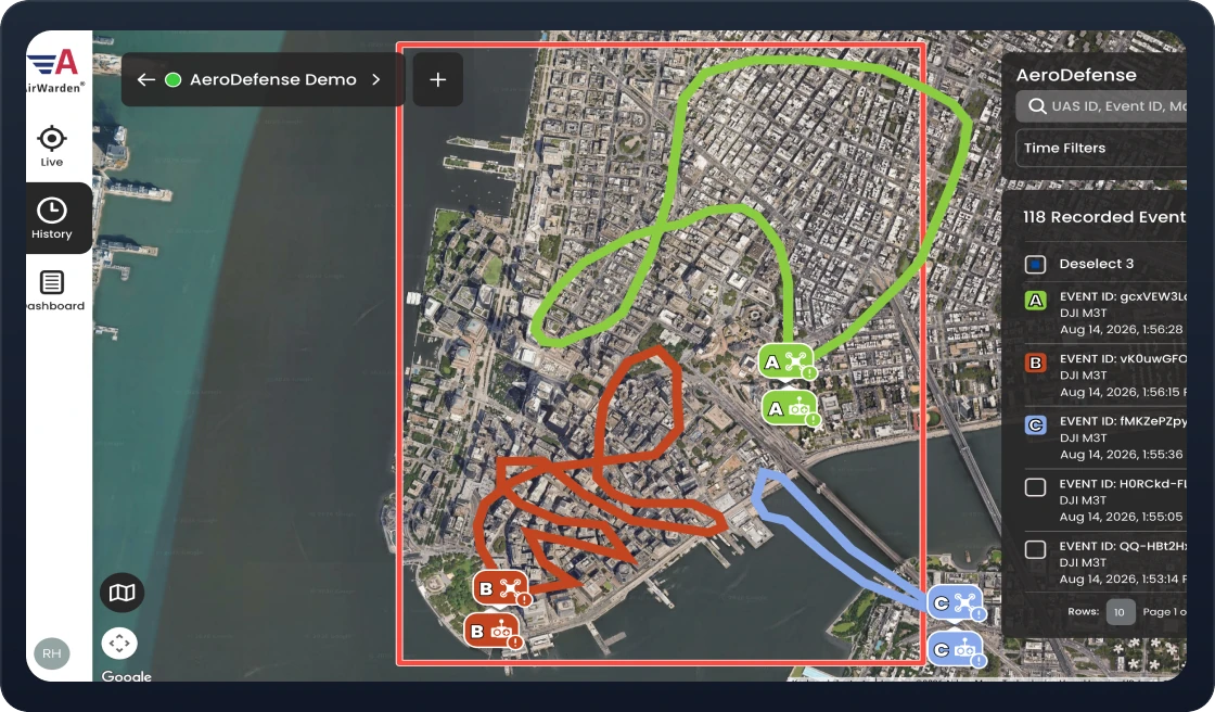
Connect your network of AirWarden Receivers or Spectrum Sensors for a single, unified view of drone activity across all your locations. From one screen, operators can instantly zoom into specific alert zones, track real-time drone and pilot coordinates, and follow live flight trajectories, giving your team complete situational awareness across multiple facilities without fragmented data.
02
Review Past Incidents
Review historical flight paths and recurring drone activity to identify potential risks before they escalate. AirWarden Essentials generates exportable, law enforcement-ready investigation reports with complete telemetry for handoffs. High-level trend charts also make it easy to report threat metrics to executive leadership or compile verified historical flight data to support your FAA UAFR application.
03
Understand Activity Trends With Built-In Dashboards
AirWarden Essentials automatically summarizes total flights, activity by drone ID and alert zone, and flight counts by hour. Dashboards also highlight the top 10 drones detected across the most distinct alert zones—helping your team spot repeat activity, recognize patterns across monitored areas, and identify drones that warrant closer attention.
04
Pre-Approve Known Drones With My Fleet
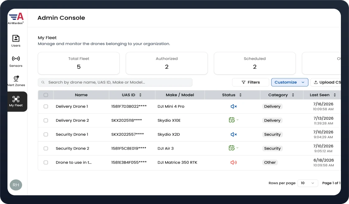
My Fleet lets you register known internal, contracted, and friendly drones in advance or directly from the live map. When recognized aircraft enter your airspace, operators can customize notification preferences, including muting routine alerts, while maintaining full, continuous flight visibility. This helps teams distinguish approved drone activity without losing awareness of what’s happening in their airspace.
05
Track Repeat Flights With Watchlists
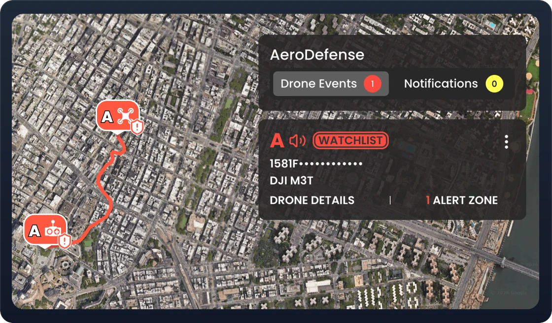
Watchlist Management lets teams flag drones of interest, add operational context, and attach response protocols. When a flagged drone re-enters your airspace, operators receive priority visual indicators on screen, while automated text and email alerts clearly identify the aircraft as a watchlist match, helping your team recognize repeat activity and respond quickly with the right information.
AirWarden Integration Capabilities
AirWarden Essentials' open-platform architecture integrates seamlessly with UTM networks, radar systems, security cameras, and GIS systems via APIs allowing you to unify your airspace defense within your existing security ecosystem.
UTM
When integrated with UTM systems, AirWarden enables continuous monitoring and management of both cooperative and non-cooperative drones, providing comprehensive airspace visibility.
The system feeds real-time drone data into UTM networks, to ensure enhanced coordination between air traffic and drone operators.
Camera
Camera systems can be integrated with AirWarden to start recording automatically when a drone is detected, giving you a visual layer to complement the drone detector features.
This enables operators to quickly verify drone activity, improve situational awareness, and support post-incident investigations.
GIS
When integrated with GIS platforms, AirWarden adds real-time and historical drone activity to the maps and operational views your team already uses.
This helps organizations visualize drone locations, flight paths, pilot locations, and alert zones alongside other geographic data for more complete situational awareness.

Radar
AirWarden's compatibility with radar systems allows it to detect drones that may not emit electronic signatures, improving detection range and accuracy.
By merging radar data with AirWarden's proprietary RF-based detection capabilities, users achieve a robust solution for detecting even stealth or low-profile drones.
UTM
When integrated with UTM systems, AirWarden enables continuous monitoring and management of both cooperative and non-cooperative drones, providing comprehensive airspace visibility.
The system feeds real-time drone data into UTM networks, to ensure enhanced coordination between air traffic and drone operators.
Camera
Camera systems can be integrated with AirWarden to start recording automatically when a drone is detected, giving you a visual layer to complement the drone detector features.
This enables operators to quickly verify drone activity, improve situational awareness, and support post-incident investigations.
GIS
When integrated with GIS platforms, AirWarden adds real-time and historical drone activity to the maps and operational views your team already uses.
This helps organizations visualize drone locations, flight paths, pilot locations, and alert zones alongside other geographic data for more complete situational awareness.
Radar
AirWarden's compatibility with radar systems allows it to detect drones that may not emit electronic signatures, improving detection range and accuracy.
By merging radar data with AirWarden's proprietary RF-based detection capabilities, users achieve a robust solution for detecting even stealth or low-profile drones.
Everything you need to know about AirWarden Essentials software and how it supports your drone detection operations.
Didn't find your answer? Chat with the AeroDefense Navigator for immediate assistance.
How much do AirWarden Remote ID and Spectrum cost?
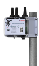
AirWarden Remote ID includes Essentials software and Remote ID Receiver hardware for $9,987 per year, per location, with unlimited users. For AirWarden Spectrum pricing, contact our sales team to discuss your facility’s needs.
Can I monitor multiple locations?
Yes. Monitor drone activity across your connected locations from one screen, then zoom in on individual sites for a closer look.
Can I customize alerts for my team?
Yes. Configure alert zones and text or email notifications to match your monitoring priorities. Use My Fleet to manage notifications for known drones and Watchlists to flag drones of interest when they return.
How does Essentials help me understand historical drone activity?
Built-in dashboards automatically summarize detection history into clear charts and activity metrics. See flight trends, peak activity times, repeat drones, and activity by alert zone to inform security planning.
Can I integrate Essentials with other systems and control which detection data I see?
Yes. Essentials supports integrations with compatible third-party radar, cameras, GIS systems, and UTM platforms. With AirWarden Remote ID, you can toggle optional radar data on or off. With AirWarden Spectrum, you can toggle Remote ID, spectrum, and optional radar data on or off.