Drone Detection FAQs

Find clear answers to common questions about drone detection, AirWarden® systems, regulations, and operational considerations.

Why do I need to worry about drones?

Drones pose significant safety and security risks, from accidental collisions with property and restricted airspace to intentional threats like unauthorized surveillance and contraband delivery.
Read our blog post to learn more about the operational risks drones create. Watch our video: Why You Need to Worry About Drones.

What industries generally use drone detection?

The most common users include critical infrastructure, public safety agencies, sports and entertainment venues, correctional facilities, and military installations.

What is the difference between detection and mitigation?

Drone Detection: Identifies, tracks, and locates drones and pilots in your airspace to provide situational awareness. Drone Mitigation: Actions taken to disrupt, disable, or neutralize a drone. Under the 2026 National Defense Authorization Act (NDAA), mitigation authority is strictly limited to authorized state, local, tribal, and territorial (SLTT) law enforcement agencies using federally approved equipment.

What is Remote ID?

Remote Identification (Remote ID) is a Federal Aviation Administration (FAA)  mandate requiring drones operating in U.S. airspace to broadcast identification, altitude, speed, and pilot location data during flight. Modern drones feature standard built-in Remote ID, while older models comply using FAA-approved broadcast modules.
Watch our video: Understanding Remote ID.

How does Radio Frequency (RF) drone detection work?

RF-based detection uses either passive sensors (which receive open signals like Remote ID or measure signal characteristics without emitting radiation) or active sensors (like radar, which transmit radio waves to calculate an object's distance, speed, and size).

Can drone detection systems locate the pilot?

Yes. A pilot's location can be determined in three ways: Remote ID Broadcasts: Receiving public location data transmitted under FAA rules. Spectrum Sensing: Analyzing RF signal characteristics (frequency, power, modulation) to trilaterate or triangulate the transmitter's location. Direct Data Extraction: Intercepting signal content to read launch coordinates directly from control channels (restricted strictly to federal entities like DoD and DHS via legal waivers). 

What is an Unmanned Aircraft Flight Restriction (UAFR)?

An Unmanned Aircraft Flight Restriction (UAFR) is a proposed FAA rule (14 CFR Part 74) that will establish a formal process for eligible critical infrastructure sites (e.g., energy, chemical, manufacturing, transportation) to apply for protected airspace. Once active, it sets defined vertical and horizontal boundaries to restrict unauthorized drone flights.
Read our full breakdown in our UAFR Overview Guide.

Which critical infrastructure sectors qualify for a proposed UAFR?

Eligibility under proposed 14 CFR Part 74 covers permanent, fixed-site facilities across CISA’s 16 Critical Infrastructure Sectors. Because eligibility requires meeting specific site screening thresholds and vulnerability criteria, refer directly to the proposed rule: FAA Proposed Rule: Designation–Restrict the Operation of Unmanned Aircraft (14 CFR Part 74) (See Subpart C, §§ 74.81–74.96).

What security measures must a facility have in place to qualify for a UAFR?

Under proposed 14 CFR § 74.56, applicants must demonstrate a multi-layered security program meeting all four criteria: Restricted Facility Access (e.g., perimeter fencing, gated access). Designated Security Personnel (dedicated physical security staff). Active Security Monitoring (continuous CCTV or security posts). Remote ID Receiving Capability 
For a complete breakdown of meeting the Remote ID requirement under § 74.56, read our Remote ID Sensing Guide.

Why can’t I just shoot down a drone?

Federal law classifies drones as aircraft. Shooting down or physically interfering with a drone is a federal crime that risks severe civil fines and criminal charges. Limited mitigation authority is granted only to specific trained law enforcement agencies under strict federal oversight.

What are the key laws concerning drone detection technologies?

In the U.S., airspace monitoring and drone detection intersect with several regulatory frameworks: FAA Regulations (14 CFR § 91.3 & § 91.15): Governs National Airspace System safety and aircraft non-interference. FCC Rules (47 U.S.C. § 301 & 47 CFR Part 15): Regulates radio frequency transmissions and spectrum usage. Privacy Laws: Protects non-public personal data and private communications. Fourth Amendment: Governs search and seizure limits for public sector and government surveillance technology deployments.
For a detailed breakdown of federal laws, wiretap compliance, and regulatory considerations, visit our Drone Detection Laws and Legal Considerations page.

What does DHS SAFETY Act designation mean?

The Department of Homeland Security (DHS) Support Anti-terrorism by Fostering Effective Technologies (SAFETY) Act of 2002 is a significant part of the United States’ response to the threat of terrorism, particularly following the events of September 11, 2001. The SAFETY Act was designed to encourage the development and deployment of effective anti-terrorism technologies and offers significant liability protections for providers and users of these technologies in the aftermath of a terror event.
For a complete explanation of how SAFETY Act protections apply to our technology and customers, visit our SAFETY Act Overview.

Are there legal considerations regarding RF-based drone detection systems at company facilities?

Yes: Standard Remote ID Reception: Capturing unencrypted, public Remote ID broadcasts (14 CFR Part 89) is standard practice and aligns with FAA guidance for establishing airspace monitoring. More details can be found in this FAA video. Non-Broadcast Detection & Payload Interception: If a drone is not broadcasting Remote ID, capturing or extracting internal aircraft identification (such as proprietary serial numbers or telemetry) by intercepting radio control signals raises potential compliance concerns under federal wiretap laws, including the Wiretap Act (18 U.S.C. § 2511) and the Electronic Communications Privacy Act (ECPA).

Who is eligible for the FEMA Counter-UAS (C-UAS) Grant Program?

Direct Applicants: State Administrative Agencies (SAAs) across all 56 U.S. states and territories submit applications directly to FEMA. Subrecipients (Pass-Through): SAAs pass through at least 97% of grant funds to local law enforcement, emergency management, fire/EMS, and municipal utilities. Private Infrastructure: Private commercial entities cannot apply directly, but can partner with local public safety agencies to include high-risk sites in regional joint grant proposals.
Read our complete breakdown of FEMA’s C-UAS Grant Program.

Can maritime facilities use FEMA's Port Security Grant Program (PSGP) to fund drone detection?

Yes. FEMA’s PSGP funds drone detection hardware, software, and training for facilities covered under an Area Maritime Security Plan (AMSP)—including port authorities, terminal operators, and commercial maritime sites. Note that PSGP requires a non-federal cost match (25% for public/non-profit entities, 50% for private operators).

Can our agency or company use Phase III sole-source contracting to procure AeroDefense solutions?

Yes. Because AeroDefense successfully completed Air Force Workforce Innovation (AFWERX)—the innovation arm of the Department of the Air Force—Direct-to-Phase II and Tactical Funding Increase (TACFI) contracts, public sector and defense organizations can leverage Phase III Sole-Source Contracting (15 U.S.C. § 638). This allows military and government buyers to procure AeroDefense technology directly without going through lengthier open-market competition cycles. 

What kind of drone detection solutions does AeroDefense offer?

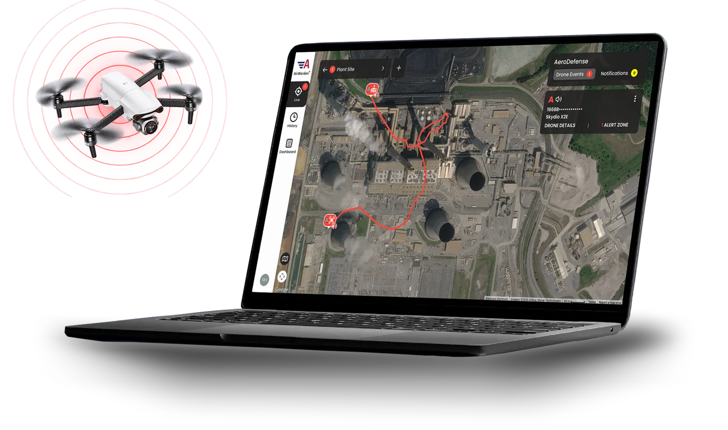
AeroDefense offers two drone detection solutions powered by AirWarden Essentials software: AirWarden Remote ID receives identification and location broadcasts from drones equipped with Remote ID. AirWarden Spectrum combines Remote ID monitoring with RF spectrum sensing to detect both drones that broadcast Remote ID and drones that do not.  Direction Finder Modules can be deployed with Spectrum sensors to enhance location accuracy. AirWarden Essentials also supports integrations with cameras, third-party radar, GIS systems, and UTM networks.
Explore our Products page.

Is the data captured just ours?

Only you see sensor details. The drone public Remote ID broadcast data goes into a “data lake”. Only a customer with their own sensor and AirWarden subscription will be able to access the system. If a customer’s sensor is near your sensor, they will provide redundancy, earlier detection and increased detection range.

How much does AirWarden Remote ID cost?

AirWarden Remote ID is $9,987 annually per location. The flat annual subscription includes both the AirWarden Remote ID receiver hardware and full access to the AirWarden Essentials software platform with unlimited user accounts, making it one of the most cost-effective professional drone detection solutions available. 

Can the AirWarden Receiver be used temporarily or moved between locations?

Yes. The AirWarden Remote ID Receiver is lightweight and installs in minutes on a tripod with no specialized tools, so you can relocate it between sites or use it for short-term events as needed. Just mount the receiver, connect power and data, and you’ll have drone detection and airspace awareness wherever you deploy it.

Why is AirWarden Remote ID so much less expensive than other solutions?

AirWarden Remote ID delivers wide-area airspace awareness at a fraction of traditional costs because it focuses on receiving standard FAA-mandated Remote ID broadcasts, which cover the vast majority of drones in operation today. By utilizing lightweight receiver hardware, built-in cellular connectivity, and a cloud-based SaaS architecture, it eliminates the need for expensive high-power processing units, costly site surveys, or ongoing system calibration. Everything—hardware, software, data, and unlimited users—is included in a single, predictable annual subscription. 

How is AirWarden Spectrum different from AirWarden Remote ID?

Both solutions are powered by the AirWarden Essentials software platform, but they utilize different detection hardware: AirWarden Remote ID: Receives FAA-mandated Remote ID broadcasts to provide cost-effective, wide-area airspace monitoring. AirWarden Spectrum: Combines Remote ID broadcast receiving with passive RF spectrum sensing to detect all drones—including non-broadcasting drones, custom/DIY builds, and legacy RF models. It is designed for higher-security sites that require detection beyond standard Remote ID.
To see a side-by-side feature and capability comparison, visit our Pricing page. 

Can your system integrate with our existing security solutions?

Yes. AirWarden features an open architecture that supports integrations with third-party radar systems, PTZ cameras (EO/IR), GIS mapping platforms, and UTM systems to provide enhanced situational awareness.

Will your system interfere with navigational aids and/or communications?

The AirWarden system is designed to minimize interference with navigational aids, Air Traffic Control (ATC), and base communications. While the system transmits data over standard commercial cellular networks, it does not use high-power jamming or disruptive RF, so it can safely operate near airfields and sensitive facilities.

Find the Right AirWarden Solution

Whether you need Remote ID monitoring or advanced RF detection, AirWarden provides scalable airspace awareness tailored to your security needs.