Law Enforcement & Emergency Management Drone Detection
See how AirWarden® helps agencies detect drone activity, coordinate response, and protect critical operations.
FY 2027 FEMA C-UAS Grant Program
Law enforcement and public safety agencies nationwide will be eligible to access $250 million in FY 2027 funding through their State Administrative Agencies.
Funding can support drone detection, tracking, and identification through third-party services or dedicated equipment—including Remote ID receivers—for specific sites and public events.
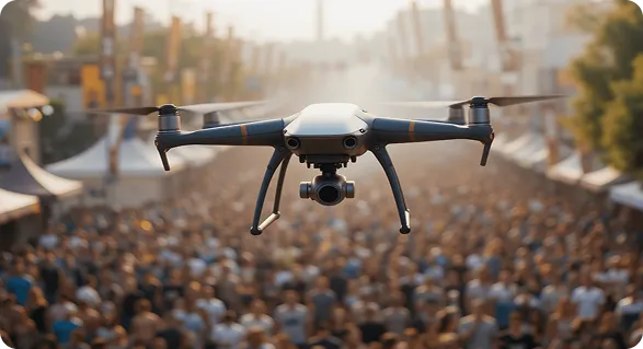
Low-flying drones over dense crowds, festivals, parades, and demonstrations create serious safety hazards and can trigger panic during public gatherings.
Tactical Disruption & Operational Blind Spots
Drones hovering over civil unrest, protest perimeters, or VIP routes can expose tactical positioning and distract command staff from critical ground operations.
SAR & Emergency Airspace Interference
Civilian drones near disaster sites, search-and-rescue missions, or emergency response corridors can force public safety aircraft to pause operations, delaying critical response efforts.
THE SOLUTION
Actionable Airspace Enforcement
Locate pilots in real time, assess intent, support safe landings, and capture verified evidence for FAA enforcement.
Live Pilot Tracking & Safe Landing
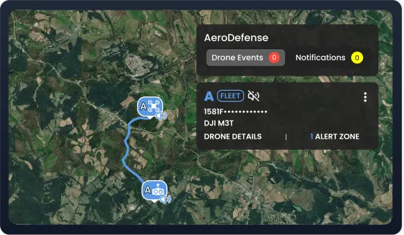
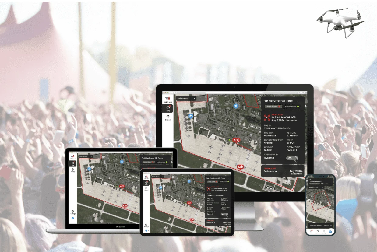
View drone and controller locations simultaneously in real time, helping officers locate the pilot, assess intent, and request a safe landing while the flight is active.
Proactive On-Scene Education
Many drone incidents involve uninformed pilots rather than malicious activity. Officers can confirm intent, explain local airspace restrictions or active TFRs, and resolve minor violations on site.
Prosecution-Ready FAA Reporting
Generate detailed forensic records including flight paths, altitude profiles, serial numbers, and exact operator coordinates to support FAA reporting, investigations, and formal enforcement or legal action.
From Drone Detection to Pilot Identification and Enforcement
Turn live drone telemetry into faster pilot identification, safer response, and stronger enforcement.
A continuous approach to drone security before, during, and after an incident.
Phase 1
Continuous Monitoring
Before an Incident
Real-Time Operational Oversight
Maintain continuous situational awareness across active incident scenes, public gatherings, and municipal perimeters through one intuitive interface with a unified real-time view.
Interference-Free Performance
Continuously monitor local airspace without disrupting critical public safety radio networks, tactical communications, emergency dispatch systems, or other essential operational communications.
Custom Alert Zones & Multi-Zone Display
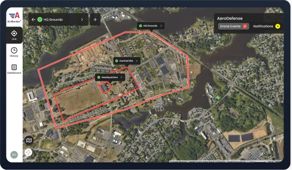
Define digital perimeters around crowds, parade routes, or tactical scenes, then monitor multiple alert zones simultaneously to support tiered response plans and coordinated dispatch.
Phase 2
Immediate Action
During an Incident
Simultaneous Drone & Pilot Tracking
View drone and pilot locations in real time on one map, helping officers quickly locate the operator, assess intent, and request a safe landing.
Broad-Spectrum Detection
Detect a wide range of drone models from major manufacturers to maintain reliable airspace visibility during active operations.
Approve Trusted Aircraft
Pre-register or approve agency, partner, and vetted media drones to reduce unnecessary alerts while keeping their flights visible.
Flag Watchlist Threats (AirWarden Remote ID Only)
Add suspicious drones to a Watchlist from live or historical data and trigger high-priority alerts if they return.
Coordinated Interagency Response
Share live flight data and pilot locations across dispatch, patrol, and mutual-aid teams for faster, coordinated response.
Phase 3
Tactical Analysis
After an Incident
Identify Flight Patterns & Repeat Activity
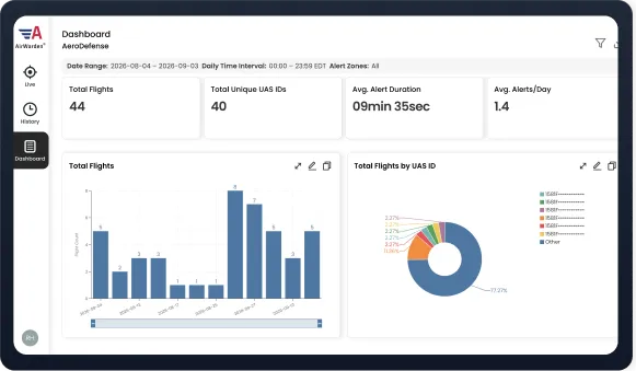
Use dashboard trends, alert-zone activity, and UAS ID data to spot recurring flights, track unknown drones, and understand activity across high-density areas.
Export Forensic Reports
Generate detailed flight logs, altitude profiles, and signal data to support FAA enforcement, court proceedings, and after-action reviews.
Evaluate Response & Tactics
Analyze post-event timeline logs to measure response times, evaluate inter-agency coordination, and justify equipment resource allocation.
Protection That Moves With Your Operations
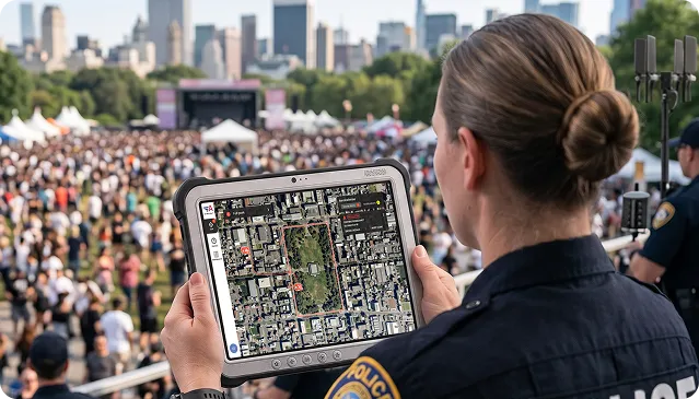
For public safety agencies and emergency managers responding to evolving situations, such as outdoor rallies, parades, VIP details, or active search-and-rescue operations, we offer portable AirWarden deployment options requiring zero permanent infrastructure.
Setup in Minutes
Mount the compact AirWarden Remote ID Receiver on a tripod, mast, or mobile unit and connect automatically via
LTE or Ethernet.
Minimal Footprint
No complex wiring or permanent hardware required. Plug-and-play deployment works at command posts, perimeter posts, or tactical sectors.
Scalable & Mobile
Use one portable unit for localized incidents or network multiple receivers across parade routes, major events, and citywide operations.
meeting REQUEST
Take Command of Your Airspace with Proven Drone Detection
Request a meeting to see how AirWarden provides law enforcement and emergency response teams with real-time drone and pilot tracking scaling seamlessly from temporary tactical deployments to city-wide public safety coverage.
Thank you! Your submission has been received!
Oops! Something went wrong while submitting the form.
Success Story
University of North Carolina at Chapel
Hill Police Department
Why Detection Mattered
Before AirWarden, UNC Chapel Hill Police relied on visual line of sight to identify drone activity, which was difficult during major events when security teams were focused on the ground.
After nine unknown drones were identified by a partner agency during a postgame celebration, the department saw the need for its own continuous airspace visibility across campus and faster insight into where drone activity was occurring.
How AirWarden Helps
With AirWarden Remote ID, UNC Chapel Hill Police has real-time visibility into campus drone activity and can locate the drone and pilot while the aircraft is airborne.
The department can distinguish trusted from unknown drones, respond accurately, monitor university policy and TFR compliance, and share information with emergency management partners and university leadership.
Get clear answers to common questions about Remote ID, drone identification, temporary deployments, evidence collection, and airspace security for law enforcement agencies.
Didn't find your answer? Chat with the AeroDefense Navigator for immediate assistance.
Does receiving Remote ID require federal authorization or legal waivers?
No. FAA Remote ID (14 CFR Part 89) is an open broadcast signal designed specifically for public safety awareness.
How does AirWarden help officers identify who owns the drone during an active incident?
Remote ID broadcasts the aircraft’s digital "license plate" (serial number), live GPS coordinates of the drone, and live location of the pilot/controller. Authorized law enforcement personnel can cross-reference the serial number captured in AirWarden with the FAA’s DiSCVR (Digital Information Service for Complex Verification and Registration) portal or consult their local FAA Law Enforcement Assistance Program (LEAP) agent to rapidly identify the registered owner.
How far does detection range extend for temporary tripod deployments?
Detection range depends on environmental conditions, terrain, and RF interference. For typical ranges in urban, suburban, and rural settings, see the AirWarden Remote ID Receiver spec sheet. For large-scale operations, such as multi-mile parade routes, marathons, or countywide events, multiple portable units can be networked together to create a seamless, multi-zone monitoring blanket managed from a single central screen.
What evidence does AirWarden generate for FAA investigations or local prosecution?
AirWarden automatically archives every detected flight, generating detailed forensic reports that include precise flight path data. These time-stamped logs provide the FAA, district attorneys, and local courts with verified evidence to enforce civil penalties or local airspace ordinances.
Isn’t Remote ID easy to bypass, and is it effective for law enforcement?
Bypassing Remote ID requires technical skills the vast majority of drone owners simply don't have. Major commercial drones broadcast Remote ID automatically out of the box, and altering that software takes advanced coding or hardware modifications.